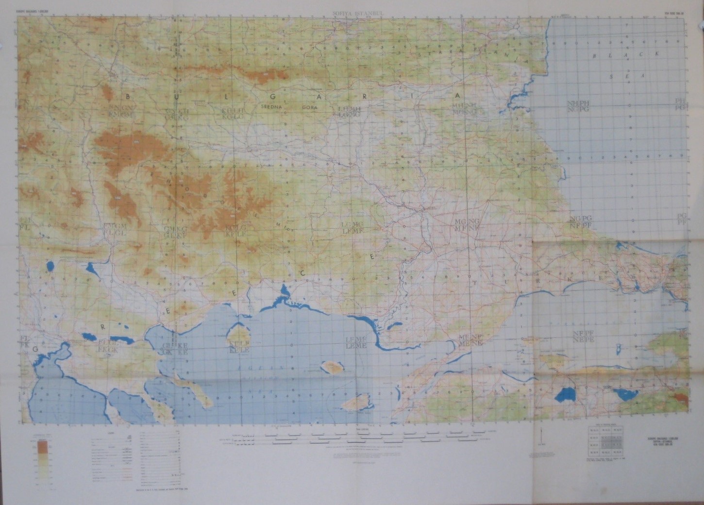
Huge 1958 USA CGSC Topo Map Balkans Bulgaria Turkey Greece Sofia Edirne Istanbul For Sale
$24.99

Item Description
Large-format color lithographed topographical map of southeastern Europe between Sofia, Bulgaria and Istanbul, Turkey, printed by the United States Army Command and General Staff College, Fort Leavenworth, Kansas in 1958.
- The map is drawn on a scale of 1:500,000 and measures a generous 91.5 x 122 cm [36" x 48"], with elevations shown in hypsometric tints.
- The coverage area includes parts of Bulagaria, Greece, North Macedonia, and Turkey.
- The map is titled Sofiya Istanbul in the upper margin, and details include railways, roads, trails, cities, towns, natural features, and international boundaries.
- Among the specific named places and features are Bursa, Dardanelles, Alexandroupolis, Rhodope Mountains, Strumica, Plovdiv, Edirne, Ahtopol, Karnobat, Kilkis, Burgas, the Stara Planina range, Struma River, Breznik, the Black Sea, and hundreds more.
- Condition: The map folds to approximately 12" x 9" and is in very good, lightly used condition, with some faint spotting and norips, tears, or writing. It is blank on the back, with no printingon the reverse side.Please see thescansand feelfree to ask any questions.
- Buy with confidence! We are always happy to combineshipping on thepurchase of multiple items — just make sure to pay for everythingat one time, not individually.
Powered by SixBit's eCommerce Solution
When you click on links to various merchants on this site and make a purchase, this can result in this site earning a commission. Affiliate programs and affiliations include, but are not limited to, the eBay Partner Network.