
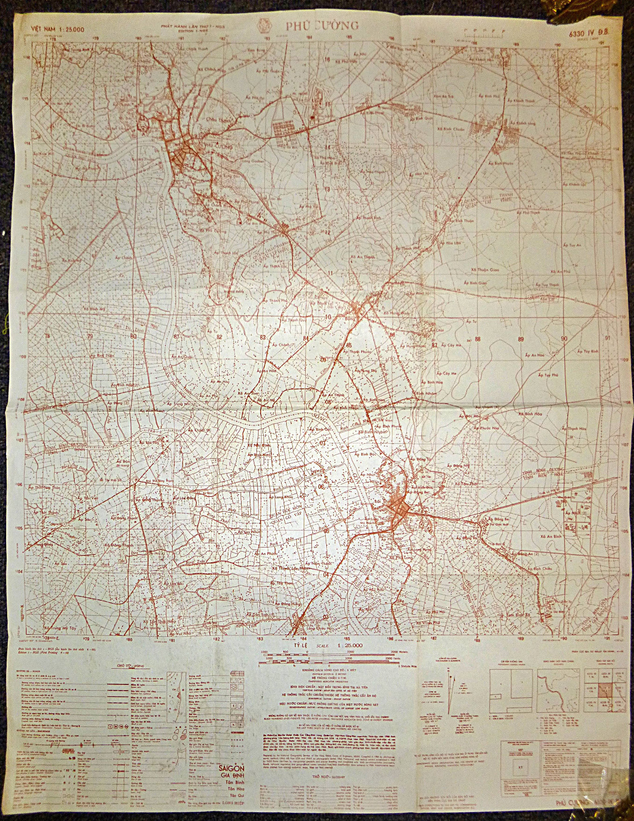

Printed APRIL - 1968 - US Special Forces - US Army - ARVN Map - Urgent Tet Print
Titled: Phu Cuong - April 1968 - 6330 iv (DB) - US map, reprinted by ARVN, Urgent Tet Print.
During the Tet Offensive of 1968, Phú Cường, the capital of Bình Dương Province, was a key target for the Viet Cong (VC) and North Vietnamese Army (NVA) due to its strategic location along the Saigon River, just north of Saigon.
Bình Dương Province was a heavily contested region throughout the war, as it contained vital transportation routes and was home to major U.S. and South Vietnamese military installations, including bases at Phú Cường and nearby Lai Khê, as well as the vast rubber plantations used by both sides for cover and operations.
On the night of January 30-31, 1968, as part of the broader Tet Offensive, Viet Cong forces launched coordinated attacks on Phú Cường, aiming to seize control of government buildings, military installations, and key roadways leading toward Saigon. The Phú Cường Bridge, spanning the Saigon River, was an essential target, as it provided a direct link to the capital. The VC sought to disrupt South Vietnamese defenses and open pathways for further attacks into the city.
The attackers included elements of the 273rd Regiment of the VC 9th Division, a well-trained and experienced force that had fought in previous major battles against U.S. and ARVN troops. The Viet Cong launched mortars and rocket attacks on military outposts before assaulting key positions, including the Bình Dương Provincial Headquarters, the ARVN barracks, and local police stations. The intense fighting quickly spread through the town, with Viet Cong units attempting to take control of streets and government buildings.
South Vietnamese ARVN forces, supported by U.S. military units, launched a counterattack. The ARVN 5th Division, stationed in Bình Dương, played a crucial role in repelling the assault. American forces from the 1st Infantry Division (The Big Red One) and 11th Armored Cavalry Regiment provided reinforcements, utilizing airstrikes, artillery, and mechanized infantry to push back the Viet Cong. Helicopter gunships from the 1st Cavalry Division provided close air support, targeting VC positions within the town and along the riverbanks.
After several days of heavy fighting, the VC forces were driven back, suffering significant casualties. The attack on Phú Cường was ultimately a failure in military terms, as the VC could not hold the town or achieve their broader objective of destabilizing the region permanently. However, like other Tet Offensive battles, it demonstrated the Viet Cong’s ability to strike in unexpected locations and contributed to the growing political and psychological impact of the offensive. The Phú Cường Bridge and surrounding roads remained a critical security concern throughout the remainder of the war, with frequent ambushes and skirmishes continuing in the region.
US MILITARY MAP - Vietnam War
Extremely Rare - Fantastic Piece.
MAP Series – L8015 - (ARVN Reprint of the US Military L7014 Series).
The 1:50,000topographic map series L8015, produced by the U.S. Army and reprinted by the ARVN during the Vietnam War,provided detailed geographical information essential for military operations.These maps were created using aerial photography and field surveys, offering acomprehensive view of specific areas in Vietnam.
With a scale of1:50,000, these maps depicted one centimeter on the map as equivalent to 500meters on the ground (or 1,000 meters per grid), allowing for precise locationreferencing and detailed representation of the terrain. The maps includedcontour lines to show elevation and terrain features such as hills, valleys,and mountains. Hydrography was detailed with rivers, streams, lakes, and otherbodies of water clearly marked, while different types of vegetation cover, suchas forests, grasslands, and agricultural areas, were also indicated.
Man-made features wereextensively detailed, including various types of roads from major highways tosmall trails, railways, bridges, and ferries. Locations of towns, villages, andcities were marked, providing a clear view of built-up areas. Military installations,such as bases, airfields, and defensive structures, were identified, along withany notable strategic points like supply depots, command centers, andcommunication hubs.
During the VietnamWar, these maps were crucial for planning and conducting military operations,enabling commanders to understand the terrain, plan routes, and locate enemypositions. The detailed topography and man-made features facilitated navigationand tactical planning.
Today, these maps arevaluable for historical research, offering insights into the geography andlogistics of military operations during the Vietnam War. They are also ofinterest to military collectors, veterans and their families, helping themlocate specific places of personal significance from the war.
