
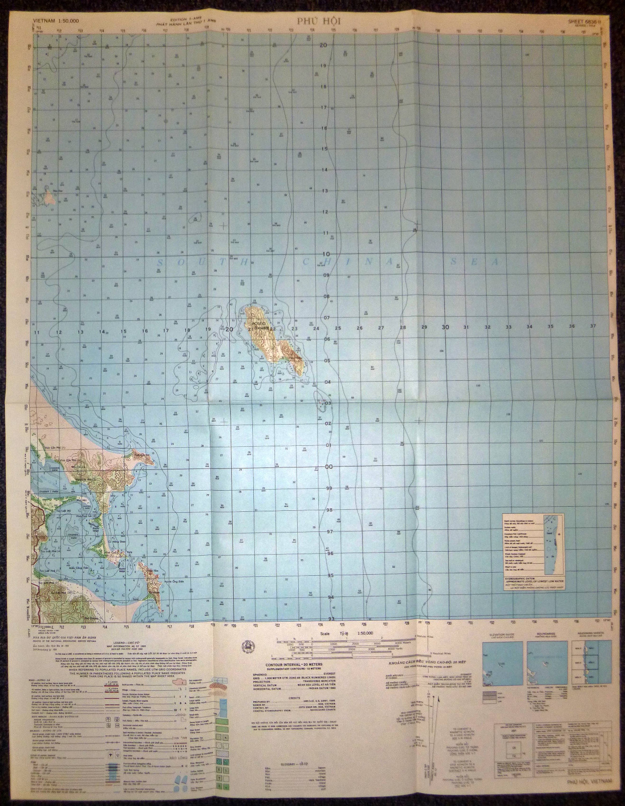

Titled: Phu Hoi
South China Sea - Poulo Gambir - Hon Hat - September 1969
Titled Phu Hoi covers a strategic segment of Vietnam’s east coast along the South China Sea, primarily within Binh Dinh and Phu Yen Provinces.
Heavily maritime in scope, with approximately 80% of the map showing open water, coastlines, and offshore islands.
The land portion of the map highlights the section of Highway 1 running through coastal hamlets, tracing a route that was critical for logistical resupply and military movement between Tuy Hoa and Qui Nhon.
The shoreline includes small fishing settlements such as Tuy Luat Hoa 1, 2, 3, and 4, part of civilian coastal communities that were subject to Viet Cong taxation, recruitment, and occasional use as resupply points for offshore infiltration missions.
The bay of Dam Cu Mona is clearly depicted, forming a natural inlet that was monitored by both ARVN naval patrols and U.S. reconnaissance aircraft for enemy sampan traffic or supply movements from the sea.
Offshore, the islands of Hon Dat and Poulo Gambir are marked in detail.
Poulo Gambir, is of particular interest. Its isolated position in the South China Sea made it suitable for observation posts, weather monitoring stations and naval beacon facilities.
The U.S. Navy, Coast Guard, and MACV naval components used this island intermittently for signal monitoring and tracking Vietnamese communist sea infiltration routes that paralleled the infamous Ho Chi Minh Trail at sea.
The political situation in this coastal corridor during the late 1960s and early 1970s was one of constant contestation. While ARVN maintained nominal control over Highway 1 and larger urban centers, the Viet Cong maintained a significant presence inland and used the coastlines as access corridors for nighttime landings, weapons drops, and intelligence transfers.
CIA operations in the area, particularly through the Provincial Reconnaissance Units and Phoenix Program, attempted to disrupt this influence through targeted raids and agent networks inserted into coastal communities.
U.S. air missions from Tuy Hoa Air Base, just south of this map’s coverage area, routinely patrolled the coast and conducted visual reconnaissance over the islands and sea approaches. These flights included Forward Air Controller (FAC) missions, radar sweeps for logistics boats, and occasional interdiction strikes against suspected VC boats hugging the shoreline.
Pointe Ong Dien, at the southeastern edge of the landmass, marks a distinct geographic feature used for coastal navigation. Its rocky headland was a natural surveillance point and used by ARVN coastal defense units for spotting night-time sea movements.
US MILITARY MAP
